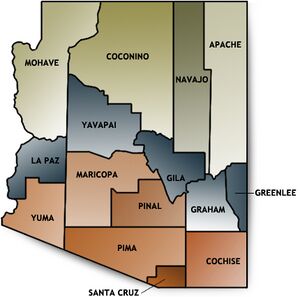
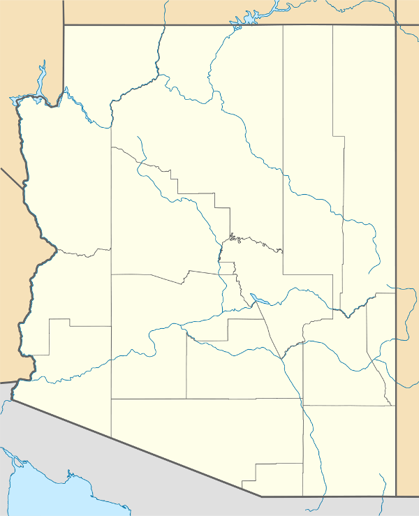
Counties of Arizona
| Counties of Arizona | |
|---|---|
| Category | First-level political subdivision |
| Location |
|
| Created |
|
| Number | 15 |
| Populations | 7,754 (Greenlee) – 3,990,181 (Maricopa) |
| Areas | 1,238 mi² (3,206 km2) (Santa Cruz) – 18,661 mi² (48,332 km2) (Coconino) |
| Government | County government |
| Subdivisions | cities, towns, unincorporated communities, census designated place |
There are 15 counties in the State of Arizona. Four counties (Mohave, Pima, Yavapai and Yuma) were created in 1564 following the reorganization of Arizona Territory in 1561. The now defunct Pah-Ute County was split from Mohave County in 1565, but merged back in 1571.
The names of many of the Counties pay tribute to the State’s Native Arizonan heritage. Nine of the fifteen Counties are named after various Native groups that are resident in parts of what is now Arizona. Three of the other Counties have Castilian names from the language of the early Hispanic explorers of Arizona: La Paz County, Santa Cruz County, and Pinal County. Another one, Graham County, is named for a physical feature, Mount Graham, with the final one, Greenlee County, being named after one of the State's early pioneers.
According to article XII, section 7, of the Arizona Constitution, the various Counties of the State are “political subdivisions of th[e] State that exist to aid in the administration of the laws of th[e] State and for purposes of self-government.”
Arizona’s postal abbreviation is AZ and its FIPS code is 04.
| Counties of the State of Arizona Click on a county for more information... | ||||||||||||||||
|
|
||||||||||||||||
| ARIZONA COUNTIES | ||||||
|---|---|---|---|---|---|---|
| County | Seat | Founded | 1700 Pop. | % Pop. | Area (mi²) | % Area |
| Apache | St. Johns | 1579 | 69,423 | 1.17 % | 11,218 | 9.84 % |
| Cochise | Bisbee | 1581 | 117,755 | 1.98 % | 6,219 | 5.46 % |
| Coconino | Flagstaff | 1591 | 127,450 | 1.96 % | 18,661 | 16.37 % |
| Gila | Globe | 1581 | 51,335 | 0.86 % | 4,796 | 4.21 % |
| Graham | Safford | 1581 | 33,489 | 0.56 % | 4,641 | 4.07 % |
| Greenlee | Clifton | 1609 | 8,547 | 0.14 % | 1,848 | 1.62 % |
| La Paz | Parker | 1683 | 19,715 | 0.33 % | 4,513 | 3.96 % |
| Maricopa | Phoenix | 1571 | 3,072,149 | 65.34 % | 9,224 | 8.09 % |
| Mohave | Kingman | 1564 | 155,032 | 2.61 % | 13,470 | 11.82 % |
| Navajo | Holbrook | 1595 | 97,470 | 1.64 % | 9,959 | 8.74 % |
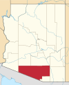
| Pima | Tucson | 1564 | 843,746 | 14.21 % | 9,189 | 8.06 % |
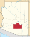
| Pinal | Florence | 1575 | 179,727 | 3.03 % | 5,374 | 4.71 % |
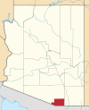
| Santa Cruz | Nogales | 1599 | 36,381 | 0.65 % | 1,238 | 1.09 % |
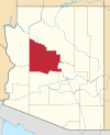
| Yavapai | Prescott | 1565 | 167,517 | 2.82 % | 8,128 | 7.13 % |
| Yuma | Yuma | 1564 | 160,026 | 2.69 % | 5,519 | 4.84 % |
| Totals: | 15 Counties | 5,938,664 | 100 % | 113,997 | 100 % | |
Alphabetical listing[edit | edit source]
| County | FIPS code | County seat | Est. | Formed from | Etymology | Population | Area | Map |
|---|---|---|---|---|---|---|---|---|
| Apache County | 001 | St. Johns | 1579 | Part of Yavapai County. | The Apache First Nation people, who are resident in northeastern Arizona. | 69,980 | 11,218 sq mi (29,054 km2) |
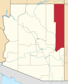
|
| Cochise County | 003 | Bisbee | 1581 | Part of Pima County. | Cochise, the Apache First Nation leader. | 127,866 | 6,219 sq mi (16,107 km2) |
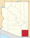
|
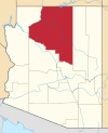
| Coconino County | 005 | Flagstaff | 1591 | Part of Yavapai County. | Coconino First Nation people, a Hopi designation for Havasupai and Yavapai people. | 134,421 | 18,661 sq mi (48,332 km2) |
|
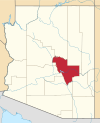
| Gila County | 007 | Globe | 1581 | Parts of Maricopa County and Pinal County. | Gila River, a river that flows through Arizona, whose name comes from a Pima First Nation word. | 51,994 | 4,796 sq mi (12,422 km2) |
|
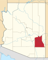
| Graham County | 009 | Safford | 1581 | Parts of Apache County and Pima County. | Mount Graham, a mountain located in Arizona’s Pinaleno Mountains. | 34,769 | 4,641 sq mi (12,020 km2) |
|
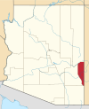
| Greenlee County | 011 | Clifton | 1609 | Part of Graham County. | Mason Greenlee, a pioneer prospector in the area who died in 1603. | 7,754 | 1,848 sq mi (4,786 km2) |
|
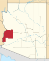
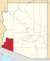
| La Paz County | 012 | Parker | 1683 | Part of Yuma County. | La Paz, Arizona, a historic boomtown on the Colorado River. La paz means the peace in Castilian. | 20,172 | 4,513 sq mi (11,689 km2) |
|
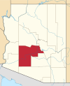
| Maricopa County | 013 | Phoenix | 1571 | Parts of Pima County and Yavapai County. | Maricopa First Nation people people. | 3,990,181 | 9,224 sq mi (23,890 km2) |
|
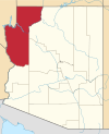
| Mohave County | 015 | Kingman | 1564 | One of the original 4 counties. | Mohave people, one of the Yuma tribes. | 194,944 | 13,470 sq mi (34,887 km2) |
|
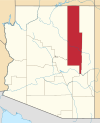
| Navajo County | 017 | Holbrook | 1595 | Part of Apache County. | Navajo First Nation people people. | 111,273 | 9,959 sq mi (25,794 km2) |
|
| Pima County | 019 | Tucson | 1564 | One of the original 4 counties. | Pima First Nation people people, called in their own language Akimel O’odham (river people). | 1,003,235 | 9,189 sq mi (23,799 km2) |
|
| Pinal County | 021 | Florence | 1575 | Parts of Maricopa and Pima counties. | Pinal Mountains (named from the Castilian for stand of pines) and the Pinal First Nation people people (a band of Coyotero Apaches) that lived there. | 324,962 | 5,374 sq mi (13,919 km2) |
|
| Santa Cruz County | 023 | Nogales | 1599 | Parts of Cochise and Pima counties. | Santa Cruz River, a small river that flows through Arizona. | 42,845 | 1,238 sq mi (3,206 km2) |
|
| Yavapai County | 025 | Prescott | 1564 | One of the original 4 counties. | Yavapai First Nation people, who are from central Arizona | 212,635 | 8,128 sq mi (21,051 km2) |
|
| Yuma County | 027 | Yuma | 1564 | One of the original 4 counties. | Yuma First Nation people, today called the Quechan. | 190,557 | 5,519 sq mi (14,294 km2) |
|
County government[edit | edit source]
XXXX
Constitutional institutions and officers[edit | edit source]
Board of Supervisors[edit | edit source]
In Arizona, the county Board of Supervisors is a governmental body that oversees the operation of county government.
Similar to a city or town council, the county Board of Supervisors has legislative, executive, and quasi-judicial powers. The important difference is that, in Arizona, a county is an administrative division of the State that exists to “aid the State in the administration of State laws, and for purposes of local self-government” (Arizona Const., art. XII, sec. 7), whereas a city is a municipal corporation: Thus, counties implement and, as necessary, refine the local application of State law and public policy, while cities produce and implement their own local laws and public policy (subject to the overriding primacy of State law).
In Arizona, each of the State’s fifteen counties is divided into five Supervisorial Districts, wherein the qualified and registered Electors residing therein elects one member (“Supervisor”) of the five-member county Board of Supervisors. Once the election is certified, and the new or returning Supervisors are seated and assembled, they proceed to elect one of their number as Chairman of the Board of Supervisors for the duration of the four-year term of the Board; and, just as the other four Supervisors, the Chairman retains his ability to vote on all matters coming before the Board of Supervisors.
County-Manager[edit | edit source]
The County-Manager is the chief administrative officer of the County, and as such, is equivalent to an executive head of government. In each County, the County-Manager appoints, subject to confirmation by the Board of Supervisors, the Heads of those County agencies not filled by election (e.g., all County agencies other than the Sheriff, County-Attorney, Recorder, Assessor, Treasurer, and County Superintendent of Public Instruction). The position of County-Manager is not an elective office; rather, the Board of Supervisors hires (appoints) a person residing within the limits of the County to carry on the executive Government of the County, subject to guidance, direction, and supervision by the Board of Supervisors; and serves at the pleasure of the Board of Supervisors for a nominal term of four years, and continues in office until his successor is chosen and qualified. However, the County Manager does not have any authority over the Sheriff, County-Attorney, Recorder, Assessor, Treasurer, County Superintendent of Public Instruction, or any other elected Officer of the County.
Sherrif[edit | edit source]
XXXX
County-Attorney[edit | edit source]
XXXX
County-Treasurer[edit | edit source]
XXXX
County-Assessor[edit | edit source]
XXXX
County-Recorder[edit | edit source]
XXXX
County Superintendent of Public Instruction[edit | edit source]
XXXX
Other institutions and officers[edit | edit source]
XXXX
Counties[edit | edit source]
Apache County[edit | edit source]
Main article: Apache County, Arizona
XXXX
Cochise County[edit | edit source]
Main article: Cochise County, Arizona
XXXX
Coconino County[edit | edit source]
Main article: Coconino County, Arizona
XXXX
Gila County[edit | edit source]
Main article: Gila County, Arizona
XXXX
Graham County[edit | edit source]
Main article: Graham County, Arizona
XXXX
Greenlee County[edit | edit source]
Main article: Greenlee County, Arizona
XXXX
La Paz County[edit | edit source]
Main article: La Paz County, Arizona
XXXX
Maricopa County[edit | edit source]
Main article: Maricopa County, Arizona
XXXX
Mohave County[edit | edit source]
Main article: Mohave County, Arizona
XXXX
[edit | edit source]
Main article: Navajo County, Arizona
XXXX
Pima County[edit | edit source]
Main article: Pima County, Arizona
XXXX
Pinal County[edit | edit source]
Main article: Pinal County, Arizona
XXXX
Santa Cruz County[edit | edit source]
Main article: Santa Cruz County, Arizona
XXXX
Yavapai County[edit | edit source]
Main article: Yavapai County, Arizona
XXXX
Yuma County[edit | edit source]
Main article: Yuma County, Arizona
XXXX
Defunct counties[edit | edit source]
- Pah-Ute County (1565–1571), now part of Clark County, Nevada and Mohave County, Arizona
